- Home
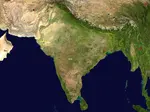
- Geography of India
- Indo-gangetic Plain
Indo-Gangetic Plain
Indo-Gangetic plain is one of the fertile and largest plains covering the northern region of India. It is also known as the Indus Ganga Plain or the North Indian plain. This fertile plain is named after the two main rivers namely Indus and Ganga. The plain is thickly populated because of the fertile land which helps in farming and agriculture. It is mainly made up of alluvial soil which is deposited by the three main rivers namely Indus, Ganga and Brahmaputra along with their tributaries.
They run parallel to the Himalayas in the north and towards the southern part is the Chota Nagpur plateau. The plain stretches 2400 km from west to east and covers an area of 700,000 square km. It is another important geographical features of India.
Update on coronavirus in India
Geography of Indo-Gangetic Plain
The Indo-Gangetic plain largely consists of alluvial soils which are deposited by the rivers that are flowing down from the Himalayas. Other the three main rivers like Ganga, Indus and Brahmaputra some of the other important rivers of this plain include Chambal, Yamuna, Ravi, Kosi, Beas, Sutlej and Meghna.
To the North of the Plain is the huge Himalayas and to the south is the Vindhya and Satpura range and Chota Nagpur Plateau. The Plain becomes relatively drier in the west as it approaches the thar desert of India. The eastern part of the plain get light rain in winter but it rains heavily during monsoon season.
 image credit-researchgate.net
Physiographic Divisions
The great Indo-Gangetic plains are divided into four Physiographic divisions:
Bhabar Belt
Tarai Belt
Bangar belt
Khadar Belt.
However some of the geographers further divide the plain into many subdivisions . They are mainly:
The Ganga Plains
The Awadh Palin
The Bihar Plain
The Purvanchal Plain
The Rohilkhand Plain
The North Bengal plain
Punjab Plain
Purvanchal plains
North Bengal plains
Ganga Yamuna Doab
Brahmaputra valley in the east.
Physiographic Divisions of Indo-Gangetic Plain
Bhabar belt:
It is located to the south of lower Himalayas and Shivalik Hills in the state of Uttarakhand in India. The belt mostly has deposits of boulders and pebbles which are carried down by the stream from the Himalayas. The streams flow underground due to the void fraction in the belt. The underground water level is deep and the belt is usually narrow with 7-15 km wide.
The belt is narrow in the east as compared to the west. Due to the narrow belt and void fraction, growing of crops is very difficult. The region is not suitable for cultivation and only large trees are grown here. The streams flow underground due to the porosity of the pebbles hence it remains dry except in the rainy season.
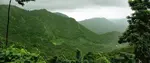
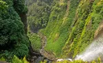
Tarai Belt: It is also spelled as Tarai is located just adjacent to Bhabar belt in the northern region of India and southern Nepal. The stream which disappears in the Bhabar belt reappears in the Tarai belt. This belt receives heavy rainfall throughout the year due to thick forest.
The belt consists of grasslands, sal forests and scrub savannah. The tarai belt spreads over the states of Haryana, Uttarakhand, Uttar Pradesh, Bihar and West Bengal. The belt is famous for good agriculture and is famous for crops like rice, wheat, maize, sugarcane, oil seeds, pulses and fodder.
Bhangar Belt:
It is the largest part of the Northern plains which has old alluvium soil. It lies more on the upland and the alluvial soil mostly has sandy loam content. In the Gangetic plain it has low upland with laterite deposits.
While the Bhangar belt consists of calcerous deposits called as Khankar the Khadir belt consists of fine silt and clay soil. A Bhangar area is further divided based on the type of irrigation- Barani are rain fed areas, Nahri- canal irrigated land and Chahi- land that is irrigated through tubewells.
Khadar belt:
It lies in the low lying areas next to Bhangar belt which are comparatively narrow. Khadar soil consists of new alluvial soil which is rich in silt content. The belt is relatively prone to floods and the river bank which is sometimes available for agriculture is sticky when wet and filled with moisture. In Punjab the Khadar flood plains are known as Betlands. Khadar is usually found near riverbeds.
Regional Divisions of Indo-Gangetic Plain
Punjab Plain:
It is a large alluvial plain in the Northwestern part of India covering the states of Punjab and Haryana. It is surrounded by Shivalik range to the north, Yamuna river to the east and arid zone of Rajasthan to the south.
It is formed by Jelum and its tributaries like the Jelum, Ravi, Sutlej and Beas. Some of the major crops grown here are cotton, cereals, oilseeds and sugarcane. The Plain is primarily made up of Doabs. Bhangar flood plains are found here due to the deposition of old alluvium and khadar rich flood plains known as bets are formed due to the deposition of new alluvium that are carried by the floods every time.
Ganga Plain:
It is an alluvial plain that lies between Ganga and Yamuna rivers. The upper Ganga Plain comprises most of the Indian states like Uttar Pradesh, Haryana, Uttarakhand, Madhya Pradesh and Bihar.
The lower gangetic plain extends across the alluvial plain of lower Ganges and Brahmaputra rivers which forms the world's largest river delta. The lower gangetic plain includes the state of West Bengal, Bihar, Tripura, Odisha, Uttar Pradesh and some parts of Assam. The main topographical variations in this region include Bhabar, Tarai, Bhangar and Khadar.
The lower Ganga plain is one of the most densely populated regions in the world. Almost all the rivers keep changing their courses making it more prone to floods. An example is the kosi river which is called Sorrow of Bihar as the annual floods affect the fertile agricultural lands. The Ganga Brahmaputra Delta is the largest delta in the world.
Brahmaputra Plain
This plain lies to the eastern part of Northern plains and lies in the state of Assam, India. The eastern boundary of Brahmaputra plain is formed by Purvanchal Hills. The region is surrounded by high mountains on all sides except to the west. The tributaries of Brahmaputra river branches out into many small rivers which forms bill and ox bow lakes. The Brahmaputra Valley is situated between hill ranges of the eastern and northeastern Himalayan range in the Eastern part of India.
The Brahmaputra Valley consists of some of the fertile soils in the world The tributaries of the Brahmaputra river form many alluvial fans. The alluvial fan is an accumulation of sediments shaped like a shallow cone. The significance of this region is the fertile soil, flat surface, perennial rivers and favourable climatic conditions. Thus some of the major crops are grown in this region.
Indo Gangetic Plain has many tourists places. Do share your thoughts with us by clicking the link here
You might like these
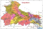
Ganga Basin - Ganga River,Climate, Pollution, Pilgrimage places
Ganga basin or Ganges basin is the part of the Ganga Brahmaputra basin draining around 1,086,000 square Kilometres in Tibet, Nepal, India and Bangladesh.
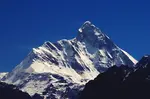
Nanda Devi - |Location, National Park, How to Reach |
Nanda Devi is the second highest peak in India. It is located in Gharwal Himalayas, Uttarakand. Nanda Devi is 23rd highest peak in the world
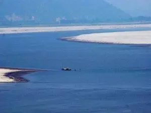
Brahmaputra River Basin
Brahmaputra river basin. In India the river covers the states of Assam, Arunachal Pradesh, Nagaland, West Bengal and Meghalaya.
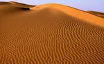
Thar Desert -- Climate, Vegetation, Flora and Fauna, Tourism
Thar desert also known as the Great Indian Desert is located in the Indian subcontinent. It is a dry arid region.
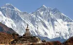
Himalayas in India- Location, Physical Features, Climate
Himalayas in India are the youngest mountain range is the world. Himalayas separate Indian sub continent from Tibet and rest of Asia
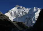
Kanchenjunga Peak -The Third Highest Peak in the World
Kanchenjunga is the third highest peak in the world. It lies partly in Nepal and partly in Sikkim.Kanchenjunga is also known as five treasures of snow
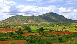
Eastern Ghats -- Geography, Hill Ranges, Climate
Eastern Ghats are discontinuous mountain range along the eastern coast of India. They run parallel to Bay of Bengal.
Deccan Plateau --Climate, History, Deccan traps,Tourism
Deccan Plateau is a large plateau that covers most parts of Southern India between Western and Eastern Ghats
Geography of India -- Climate, Boundaries, Facts, Plateau
Geography of India- India has all the geographical factors like the deserts, coastal areas, plateaus and the mountains.
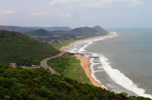
Coastal Plains of India --Eastern and Western Coastal Plain.
The coastal plains of India run on both the sides of the peninsular plateau along the eastern and western coasts of India.
Western Ghats--Highest Peak,Geography, Rivers, Flora and Fauna
Western Ghats is the longest mountain ranges that run parallel to the western coast of India. The Ghats covers the state of Kerala, Karnataka, Tamil Nadu, Goa, Maharashtra and Gujarat
Kamet peak. | Trisul Peak |Shivling Peak |Chaukambha Peak|
Kamet is the second highest mountain peak of the Himalayas located in the Garhwal region of Uttarakhand, India

Affiliate Disclosure:
If you make any purchase via a link on this site, I may receive a small commission with no added cost to you.
Check here for Beautiful designer wear Designs
Recent Articles
-
Agumbe --- |Karnataka| | Waterfalls| |Western Ghats |Tourism|
Mar 31, 25 05:56 AM
 Agumbe is a beautiful serene village located in west coastal region in Shimoga district,Thirthalli taluk in Malnad region of Karnataka, India.
 -
Belur Chennakeshava temple, Karnataka, India
Mar 31, 25 05:53 AM
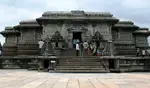 Belur is world famous for the Chennakeshava temple built during Hoysala period. Belur is also known as Velapura
 -
Badami Cave Temples, History, How to Reach, Best Time to Visit
Mar 31, 25 05:48 AM
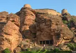 Badami is located in Bagalkot district of Northern part of Karnataka. The place is world famous for the cave temples built during the Chalukya period.
Reach us on and share your feed back on
contact us
Popular pages
Indian art, Indian architecture, Religions of India, culture of India, History of India, Tourism in India, Yoga, ancient India, Indian Music, Indian Dance, India Independence Movement, Indian Dynasties, Ayurveda, Indian Folktales, Geography of India, National Parks in India, National Symbols of India